The Pioneer Valley (the “Valley”) comprises a central portion of the Connecticut River Basin as it passes north-to-south through Massachusetts. The valley is segmented into two portions, the upper portion stretches from the town of Easthampton to the small city of Greenfield, while the lower region encompasses the metro areas of Springfield and Holyoke.
This story focuses on the upper portion, which is today approximately 14 miles wide, east to west, and 24 miles long. The average elevation of the valley floor in this area is around 130 feet above sea level and is closely bound by the Berkshire Mountains to the west, the Pelham Hills to the east, and the Holyoke Range to the south. Each was formed during a specific prehistoric period, separated by millions of years, by different tectonic forces.
Tectonic plates collided and millions of years later rifted apart affecting local geomorphology, as did repeated thickening and thinning of the earth’s crust. By 300 Ma it was was what it is today. In the process these forces together created ancient landforms and some of the rock beneath the generally more recent landforms in and around the Valley today. During the Triassic and Jurassic periods dinosaurs populated the Valley in great numbers. The first tracks discovered anywhere on Earth were found in the Valley at the beginning of the 1800’s. During the last ice age 20,000 years ago an ice sheet a mile thick crept down the Connecticut River Basin, forming its terminal moraine as what became Long Island, NY and in the process forming many glacial drumlins around what is called today the Pioneer Valley. The ice sheet retreated to central Connecticut, and around 18,000 years ago a barrier formed in the present town of Rocky Hill damming the Connecticut River and as the ice melted a narrow series of water bodies today known collectively as Lake Hitchcock extended north some 150 miles over a 4,000 year period. Nearly the entire Pioneer Valley was submerged beneath these cold waters during its existence. There are some 4,000 annual varves in the Lake’s chronology. These yearly deposits of sediment which settled to the lake bottom indicate that for about 1,400 years of this period water covered the core of what is today the University of Massachusetts Amherst campus. Lake Hitchcock drained from the Pioneer Valley around 14,000 years ago, evidenced by dunes on the then dry lakebed that can still be discerned today.
In considering the geology and the evolving geomorphology of the Pioneer Valley, it helps to go back to the beginning. About 1 billion years ago the ancestral North American plate formed part of a larger “supercontinent” called Rodinia. Located near the earth’s south pole, Rodinia began rifting apart ca. as early as 900 million years ago (Ma). At this point the North American continent, called Laurentia, was smaller than today, lacking what became its eastern and western coastal areas. By about 500 Ma, the proto-continent was near the equator, with what is now the east coast of North America facing south. Beginning around this time, the present-day eastern part of the continent grew incrementally in a series of tectonic events involving the accretion of terranes, or fragments of the earth’s crust and underlying mantle.
Some terranes were volcanic island arcs while others, larger, are sometimes referred to as microcontinents. The floor below the Pioneer Valley may consist largely of the Gander Terrane. It is thought to have broken from the paleo-continent of Gondwana (basically what was Africa and South America) and collided with Laurentia about 430 Ma. The Avalon Terrane forms the crust under much of eastern Massachusetts. It accreted (“collided”) with Laurentia about 380 Ma in a major tectonic event called the Acadian orogeny. At this time, rocks that now underlie the Pioneer Valley were faulted and folded, and ultimately buries within a thick Himalayan-scale mountain belt. Sediments from the range shed to the west as fas as present day Buffalo, NY.
Still later, about 300 Ma, the entire continent of Gondwana collided with Laurentia in the Alleghenian orogeny forming a single supercontinent that is called Pangaea, or “all-earth.” The planet was covered by a single continent and a single huge ocean. What is today the Pioneer Valley was many miles from any coastline. Beginning around 220 Ma, Pangaea began to break apart, forming a series of fault-bounded rift valleys including the Connecticut Valley rift and the Eastern Border Fault. This rift valley was filled with thousands of feet of sediments including the Sugarloaf arkose and Mt. Toby conglomerate. Several distinct lava flows including the Holyoke and Deerfield basalts filled the valley about 200 Ma and were buried by more sediments. They now hold up prominent ridges in the Pioneer Valley including the Holyoke Range to the south.
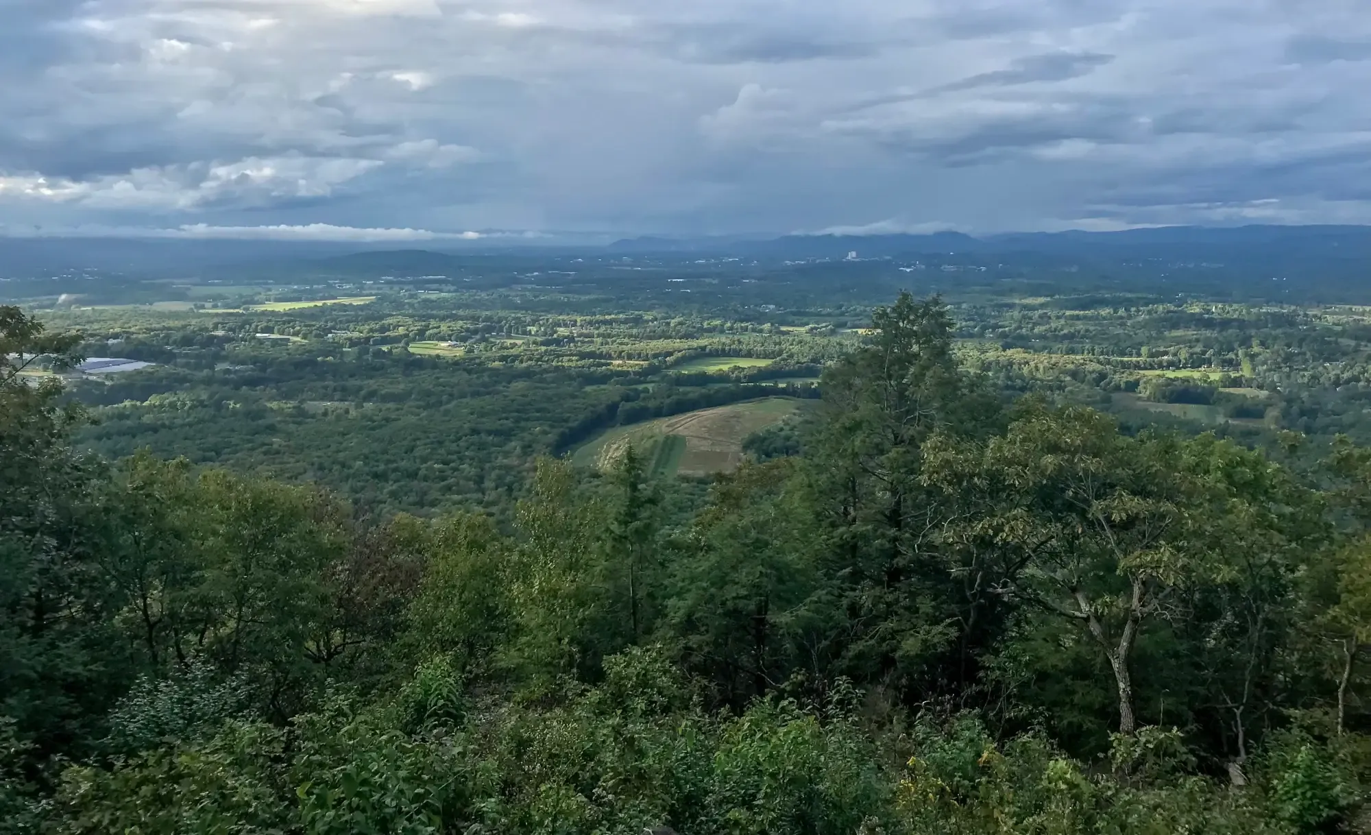
Finally, a word about the observatory location. Mt. Pollux is one of two named drumlins located in the Town of Amherst, which is located at the eastern edge of the Pioneer Valley. Drumlins are streamlined hills made of sediments that were deposited under and shaped by the glacial ice. For the story told here the reader can or imagine they are standing atop this 345-foot highpoint, with its 360-degree views, observing the surrounding landforms located within a close radius of the vantage point.