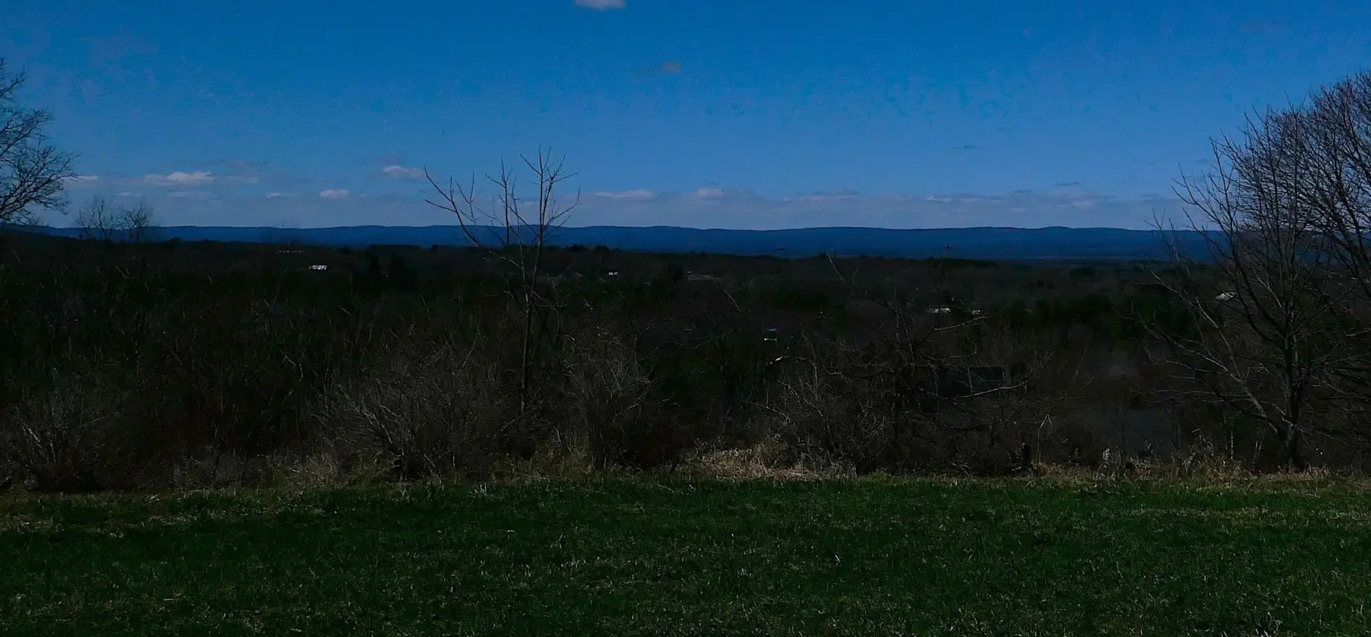
Looking west from atop Mt. Pollux the skyline is formed by the Berkshire Mountains some 12 miles away, part of one of the older topographical ranges in North America. Today’s landform extends into Vermont as the Green Mountains and south into northeastern Connecticut as the Litchfield Hills. The original Berkshires landform was formed by thrust faulting some distance west of what became the Connecticut River Basin through the mountain building process known as an orogeny. This began during the Taconic orogeny in the mid-to-late Ordovician period (480 Ma – 450 Ma), with significant uplifting later during the Acadian orogeny. These first mountains are thought to have been at least as tall as the European Alps are today, but soon began eroding down as all mountain ranges do. The rock of the Berkshires can also be found in the Taconic Mountains of eastern New York and the Green Mountain massif of southwestern Vermont. Together, geoscientists refer to these ranges as the “Taconic Highlands.”
A little over a decade ago, research by geoscientists in and around the Pioneer Valley led to speculation that the first peri-Gondwanan terrane to collide with Laurentia, beginning the Taconic orogeny, was the Moretown Terrane, which consists of metasedimentary rock deposited around 480 Ma. Moretown accreted with Laurentia forming the principal suture known by geoscientists as the “Iapetan Suture” which closed the Iapetan Ocean separating Laurentia and Gondwana. It passes through the boundary of the upper Pioneer Valley, the line runs north-south at the longitude of 73oW, basically in the middle of the Berkshires through the towns of Windsor and Savoy. Along the suture line, i.e., the Moretown-Laurentia boundary, ancient rock from opposite sides of the planet today sits side-by-side. https://francismacdonald.fas.harvard.edu/files/fmacdonald/files/macdonald_moretown_geology_2014.pdf.
The collision began the uplifting of the Berkshire Massif on Grenvillian (Laurentian), composed of aged gneiss, some of which is exposed today in small outcroppings, was generally overlaid with younger continental shelf sedimentary rock which at times formed into metamorphosed rock such as the at least 400-million-year-old mica garnet schist known colloquially today as Ashfield Stone, part of the Goshen Formation. Relatively small gneiss domes emerged in the eastern Berkshires near Shelbourne Falls and Goshen around 300 Ma.
The next major volcanic arc to collide, between 475-450 Ma, is known as the Bronson Hill Island Arc. As part of, or possibly after the Taconic Orogeny, plate subduction triggered faults, volcanic activity and quakes before the collision of the Gander Terrane about 430 Ma. Aside from expanding the size of Laurentia and forming the major mountain ranges in what is now Western Massachusetts, the crust from Gander today underlies the Pioneer Valley. The remnants of Bronson Hill arc form the eastern edge of the Pioneer Valley, encompassing three sides of the Pelham Dome discussed below.
The Acadian Orogeny occurred during the Devonian Period (417 – 360 Ma) and involved several micro-continent terranes including the Avalon around 380 Ma. This event was centered to the east of what became the Connecticut River basin, adding to the North American plate and significantly impacting the range. At this time, rocks that now underlie the Pioneer Valley were faulted and folded, and ultimately buried within a thick Himalayan-scale mountain belt. Sediments from the range were shed westward as far as present today Buffalo, NY.
During the Alleghenian Orogeny (325 – 260 Ma) the continent of Gondwana (Africa) collided with Laurentia to form the supercontinent of Pangaea. This orogeny affected the southeastern portion of the plate and formed the southern Appalachian and Allegheny mountains. There was significant deformation in eastern Massachusetts, Connecticut and Rhode Island. During these more recent periods within the Paleozoic Era the Berkshires were more likely not growing, but rather weathering down.
The high point in Massachusetts is Mt. Greylock (3,489 ft.), located between North Adams and Pittsfield in the far west of the state, and given this location one might assume it is in the Berkshires. The fact is, however, that from a geological perspective it is part of the Taconic Highlands. Compressive forces at the continental margin thrust most of this formation westward into what is today New York state. However, all but the most resistant stone of the Taconic Highlands eroded away and collapsed, mostly to the west. Greylock is an exception consisting of exposed ancient Taconic rock.
The complex geomorphology and topography of this border area between the Taconic and Berkshire ranges is illustrated by the watershed of the Hoosic River which begins its flow there. All the major rivers in Massachusetts flow from north to south and through Connecticut and Rhode Island into Long Island Sound, reflecting the dominant geomorphological orientation of the region. Not so the Hoosic, which flows in a northwesterly direction cutting through the southwestern corner of Vermont before turning due west and emptying into the north-south flowing Hudson. The headwaters of the Hoosic are only a few miles from the edge of the Housatonic River watershed, which while flowing to the south divides the southern Berkshire and Taconic ranges.
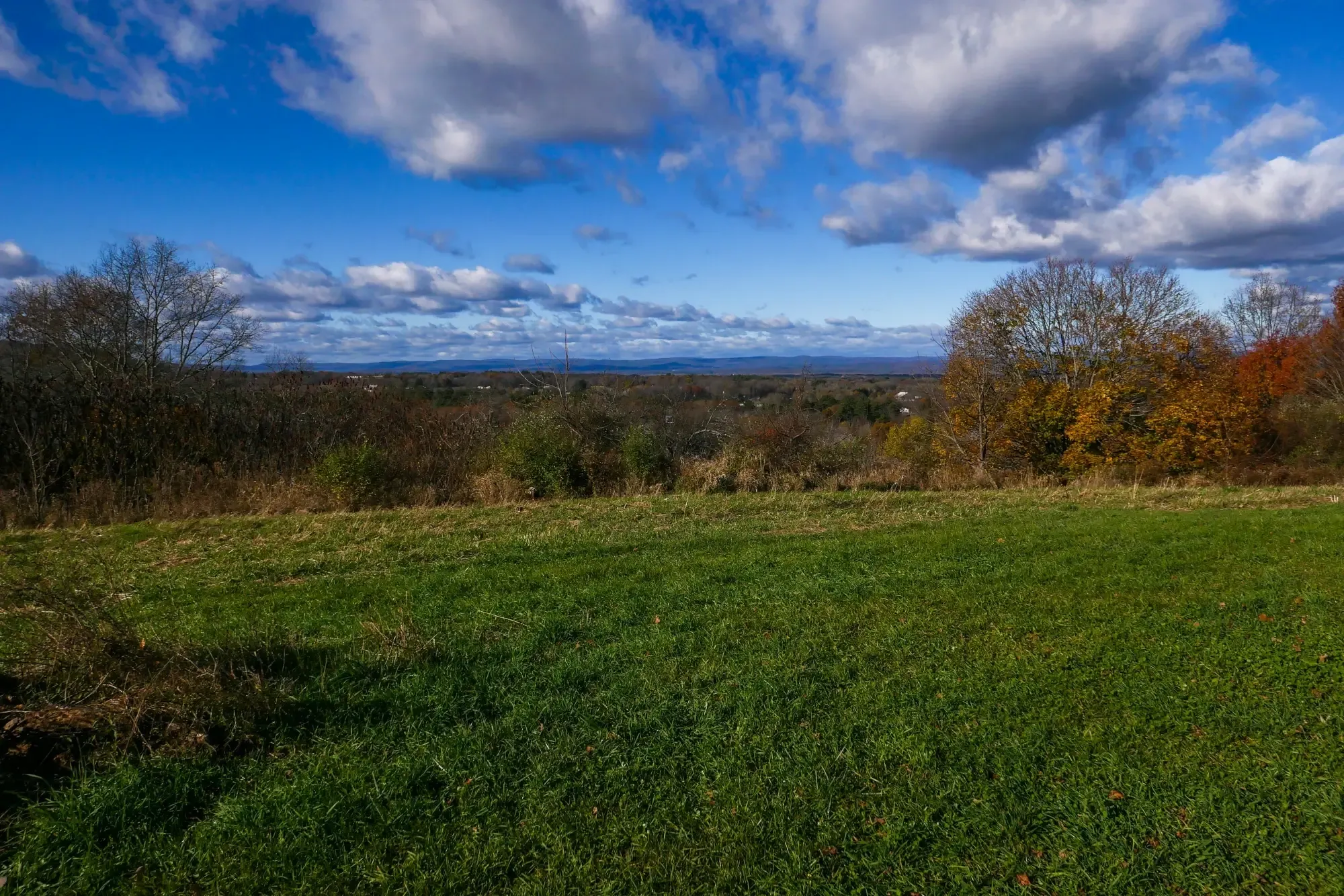
Still looking west from Mt. Pollux, in the middle ground the Connecticut River can be seen flowing north to south through its broad basin. It is the longest river in New England stretching just over 400 miles from the Canadian border to Long Island Sound, draining a watershed of over 11,000 square miles. Within the Pioneer Valley the river reaches both its maximum depth and width, respectively in different locations at the northernmost and southernmost ends of the valley. The largest falls on the river also are located in the Pioneer Valley. Major tributary rivers in the valley are the Deerfield and Westfield on the west of the basin, and the Millers and Chicopee on the east. There are two sub-basins within the Pioneer Valley, the Deerfield in the north and Hartford in the south, divided at the Amherst Block (see below).
Today’s Connecticut River Valley began as a fault basin/rift valley consisting of multiple fissures which stepped outward as the rift valley developed. The Eastern Border Fault which lies just east of the valley is one. The sedimentary basin within the valley stretches from just north of the Pioneer Valley to New Haven with an average width of 17 miles and sediment, primarily Arkose sandstone, of up to 16,000 feet in depth. Between 220 – 200 Ma, as Pangaea began to break up, the fault line created a distal rift valley which evolved to become the Connecticut River basin. At its peak, during the late Triassic and early Jurassic periods, this landform may have looked like the Great Rift Valley in East Africa and later California’s Death Valley does today. However, over a few million years plate expansion created the series of parallel rift valleys to the east, one of which formed the Mid-Atlantic Ridge, a rift which widened over millions of years to create the northern Atlantic Ocean, separating Laurentia and Gondwana.
Much more recently, 75,000 – 11,000 years ago, the Laurentide Ice Sheet filled the basin and indeed covered all of Massachusetts and much of New England. Cape Cod, Long Island, Nantucket and Martha’s Vineyard were all formed during this period. So was the Mt. Pollux vantage point, which as noted earlier is a glacial drumlin composed of stones and glacial till scraped forward as the ice advanced. There are a couple of theories as to how drumlins are formed. The most likely for Mt. Pollux (345 ft.) and Mt. Castor (310 ft.) is called “constructional” whereby till is deposited by subglacial waterways. This landform remains when the ice sheet recedes.
Drumlins are commonly found together in fields or “swarms.” One of the largest of these in the world is found in Wisconsin. Professor Emeritus of Geology at Greenfield Community College, Richard D. Little, has studied the geo-history of the Connecticut River Valley for decades and believes 100 other drumlins can be found scattered throughout Pioneer Valley. What makes Mt. Pollux unique among all these drumlins is that forest was cleared in the 1800s for apple orchards. The town of Amherst conservation area, managed in partnership with the Kestrel Land Trust, today remains clear of tall trees on the summit, allowing views like nowhere else within the upper Pioneer Valley.
The ice sheet began to recede about 22,000 years ago, and 16,000 – 15,000 years later or so a glacial dam formed near Rocky Hill, CT, creating a long series of glacial lakes stretching north more than 150 miles, together known as Glacial Lake Hitchcock. The lake’s water level varied by location and period but is estimated to have had an average elevation of around 300 feet above sea level. Nearly the entire Pioneer Valley was beneath water for the 4,000 – 5,000-year period before the series of lakes completely drained. In the northern portion of the valley what is today referred to as Lake Montague formed with a southern edge near Mt. Sugarloaf. From there to the gap between the Holyoke Range and Mt. Tom is known as Lake Hadley. Within this portion of Lake Hitchcock only the highpoints of the Amherst Block, including Mt. Warner, and the very tops of Amherst’s two main drumlins stood above the lake surface. Today, evidence of the series of lakes in the Pioneer Valley consists of exposed varves which reflect annual deposits of sediment mud from runoff, flat landforms denoting former delta areas and alluvial fans (one formed between Mt. Pollux and Mt. Castor), often underlaid with sand and gravel deposits, and the deep sediment over the valley floor which help made it a fine source of raw material for brick making and one of the most fertile and productive agricultural areas in the Northeast.